-

by
Zak Failla
Breaking News
Suffolk County Executive Steve Bellone declared a State of Emergency amid the first Nor’easter of the season with more intense weather expected to strike Long Island.Shortly after noon on Tuesday, Oct. 26, Bellone announced that he was issuing the State of Emergency for the county, advising that “residents should stay alert, as this storm is far from over.” Suffolk County Executive ...
-

by
Zak Failla
Breaking News
Hundreds of Long Island residents were left in the dark overnight as a Nor’easter rolled through the region dropping upwards of six inches of rain and wind gusts approaching 60 mph.Earlier story - Projected Rainfall Totals Increase For Powerful Nor'easter Which Could Bring 60 MPH Wind GustsOvernight, PSEG Long Island reported that nearly 2,000 customers were left without power in the ...
-

by
Joe Lombardi
Weather
A powerful Nor'easter is sweeping through the region, bringing even more rainfall than originally projected, scattered flash flooding, and damaging wind gusts up to 60 miles per hour that could cause power outages.Rain will be steady throughout the day on Tuesday, Oct. 26, and into the evening and overnight hours before finally tapering off late Wednesday morning, Oct. 27. (See the ...
-

by
Joe Lombardi
Weather
A Severe Thunderstorm Watch has been issued for a large portion of the Northeast.It's in effect until 11 p.m. Saturday, July 17.Damaging wind gusts in excess of 60 miles per hour are the main threat with any thunderstorm that becomes severe, the National Weather Service said in issuing the watch.Torrential downpours, frequent lightning, and flash flooding are all possible, along with ...
-

by
Joe Lombardi
Weather
Click here for an updated story: Severe Thunderstorm Watch In Effect, With 60 MPH-Plus Wind Gusts Expected, Tornadoes PossibleA new round of severe thunderstorms is expected to sweep through the region.The time frame for storm activity is from mid-afternoon, Saturday, July 17. through late Saturday night.The primary threat is damaging wind gusts, the National Weather Service said in a ...
-

by
Joe Lombardi
Weather
As Tropical Storm Isaias nears, a Tornado Watch has been issued for much of the region.The watch is in effect until 4 p.m. Tuesday, Aug. 4. It is for areas mainly south of I-84 in New York and Connecticut. (See image above.)Related story - Tracking Isaias: Strong Winds That Could Cause Power Outages, Possible Tornadoes Among ThreatsThe main threats with this the storm system are heavy ...
-

by
Joe Lombardi
Breaking News
This story has been updated.The eye of Tropical Storm Isaias is expected to track near the New York/Connecticut border after it arrives in the region on Tuesday afternoon, Aug. 4.Drenching rain may lead to flooding and winds between 35 to 45 miles per hour with gusts as high as 60 to 65 mph could cause power outages.In addition, the storm may be accompanied by isolated tornadoes, ...
-
by
Joe Lombardi
Weather
This story has been updated.The eye of Tropical Storm Isaias is expected to track near the New York/Connecticut border after it arrives in the region on Tuesday afternoon, Aug. 4.Drenching rain may lead to flooding and winds between 35 to 45 miles per hour with gusts as high as 60 to 65 mph could cause power outages.In addition, the storm may be accompanied by isolated tornadoes, ...
-

by
Joe Lombardi
Weather
Drenching rain, possible flooding and wind gusts of 50 miles per hour will hit the region as Tropical Storm Isaias makes its way up the East Coast.The time frame for Isaias' strongest impact in this area during the afternoon and into the evening on Tuesday, Aug. 4.A Tropical Storm Warning and Flash Flood Watch cover the entire region from 6 a.m. Tuesday to 6 a.m. Wednesday, Aug. 5. A ...
-

by
Joe Lombardi
Weather
A powerful tropical storm will soak the region with downpours leading to localized flash flooding and travel disruptions with dangerous wind gusts that could cause power outages.The system, Tropical Storm Fay, is the sixth named storm of the season, the earliest that's happened.The time frame for the storm is Friday, July 10 into Saturday, July 11. The worst of the weather should be ...
-

by
Joe Lombardi
Weather
A tropical storm moving up from the Atlantic Coast is expected to soak the region and bring localized flash flooding and travel disruptions.The storm, just named Tropical Storm Fay, is the sixth named storm of the season, the earliest that's happened.The time frame for the storm is Friday, July 10 into Saturday, July 11.A Tropical Storm Warning has been issued for coastal New York, ...
-

by
Joe Lombardi
Weather
This story has been updated.Lines of scattered, severe thunderstorms are sweeping through the area from west to east.Some of the storms, first spotted late in the afternoon on Sunday, Aug. 18, are packing winds up to 60 miles per hour. Severe Thunderstorm Warnings were issued for Manhattan as well as extreme Southern Westchester, southern Putnam County and western Dutchess County. A ...
-

by
Zak Failla
Breaking News
Hundreds in Fairfield County are still in the dark the morning after thunderstorms rocked the region, bringing gusty winds and heavy rain, sending trees and power lines flying.As of 8:40 a.m. on Tuesday, July 23, Eversource is still working to restore power to 604 of their 1,275,212 in Connecticut, including dozens in Fairfield County.Outages were reported in Brookfield, Darien, ...
-

by
Zak Failla
Breaking News
Nearly 2,500 Long Islanders are still in the dark the morning after thunderstorms rocked the region, bringing gusty winds and heavy rain, sending trees and power lines flying.As of 8:20 a.m. on Tuesday, July 23, PSEG was still working to restore 370 outages which is impacting 2,499 of their 1,162,122 customers.In Suffolk, 507 customers were reporting outages. Huntington (241 outages) ...
-
by
Joe Lombardi
Weather
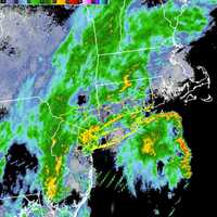
The severe thunderstorms that brought torrential rain, frequent lightning, huge hailstones and damaging wind gusts have moved out of the area, but flooding will be a concern on Tuesday, July 23.Most of the steady and strong storm activity ended by midnight, but thousands of residents in the region remain without power and scattered rounds of heavy rain have been making the morning ...
-

by
Joe Lombardi
Weather
As a powerful storm system from the remnants of post-tropical cyclone Barry moves through the area, a Severe Thunderstorm Warning is now in effect for parts of the area.The warning, issued at 7:30 p.m. Wednesday, July 17, is for the areas shown in the image above. The storms have torrential downpours, frequent lightning and damaging winds with gusts up to 65 miles per hour could bring ...
-

by
Joe Lombardi
Weather
This story has been updated.As a powerful storm system from the remnants of post-tropical cyclone Barry closes in, Severe Thunderstorm and Flash Flood watches have now been issued for the entire region.Some of the storms on Wednesday, July 17 will have torrential downpours, frequent lightning and damaging winds.Wind gusts of up to 65 miles per hour could bring down trees and power ...
-

by
Joe Lombardi
Weather
This story has been updated.A powerful storm system from the remnants of post-tropical cyclone Barry will be posing their first threat to the area on Wednesday, July 17.The entire region is in the "possible" zone for a risk of severe weather. (See the first image above.)Scattered severe thunderstorms are possible for a 12-hour period. Some of the storms will have torrential downpours, ...
-

by
Joe Lombardi
Weather
A storm system is bringing heavy downpours that are causing flooding and travel issues in some spots of the area at the start of the holiday weekend.More thunderstorms are possible, mainly in the morning, Saturday, April 20.A Flash Flood Watch is in effect until 2 p.m. Saturday. Flooding will be most likely on streams, creeks and rivers through Saturday afternoon. There will also be ...
-

by
Cecilia Levine
Weather
The National Weather Service issued a flash flood watch across North Jersey Friday and Saturday.A slow-moving system beginning Friday night could bring up to one inch of rain to parts of Bergen, Hudson, Essex and Union through Saturday afternoon, the NWS said."The biggest threat remains gusty winds, and we can also add localized flooding in poor drainage areas," meteorologist Joe Cioffi ...
-

by
Joe Lombardi
Weather
A storm system that will bring heavy rain, thunderstorms and gusty winds has prompted the National Weather Service to issue a Flash Flood Watch for the region.The watch is in effect from 2 a.m. to 2 p.m. on Saturday, April 20.Friday, April 19 will be mostly cloudy and warmer with a high temperature in the upper 60s. There will be patchy drizzle and a chance of showers throughout the ...
-

by
Joe Lombardi
Weather
It's a wet mess. And a windy one too.A storm bringing heavy downpours and strong winds between 20 and 30 miles per hour with gusts up to 50 mph is barreling through the area.Up to 2.5 inches of rainfall is possible before it winds down late in the afternoon.A Flash Flood Watch is in effect until 6 p.m. on Thursday, Jan. 24 for the entire area. A Coastal Flood Advisory has been issued ...
-

by
Joe Lombardi
Weather
Get set. It's going to get wet.A 24-hour storm will bring heavy downpours and up to 2.5 inches of rainfall.A Flash Flood Watch is in effect from 6 a.m. to 6 p.m. on Thursday, Jan. 24 for Westchester, Putnam, Rockland, Orange and Fairfield counties.The storm will arrive along with a brief surge of warmer air. The chance for rain starts at around 3 p.m. on Wednesday, Jan. 23 on a mostly ...
-

by
Joe Lombardi
Weather
A powerful storm will slam the area just as thousands hit the highways for pre-Christmas travel.Heavy rain, strong gusty winds, coastal flooding is expected from Thursday night through the day on Friday. Widespread 2 to 3 inches of rain is likely with locally higher amounts possible which can lead to flooding, according to the National Weather Service. Coastal flooding is also a ...
-
by
Joe Lombardi
Weather
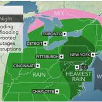
A significant storm system in the pre-Christmas travel days at the end of the week is headed our way. Heavy rain, wind, and coastal flooding are all likely.A Flash Flood Watch is now in effect from 1 a.m. Friday, Dec. 21 until 1 a.m. Saturday, Dec. 22.The National Weather Service is now forecasting 1.5 to 2.5 inches of rain with locally higher amounts, especially in any thunderstorms, ...
-

by
Cecilia Levine
Weather
The first post-Thanksgiving workweek will get off to a stormy start.The same storm that brought blizzard conditions to parts of the Midwest will sweep through the Northeast on Monday, bringing heavy rain, gusty winds and challenging conditions for motorists during the evening commute.The National Weather Service has issued a flash flood watch for Bergen, Passaic, Essex, Hudson and ...
-

by
Joe Lombardi
Weather
The first post-Thanksgiving workweek will get off to a stormy start.The same storm that brought blizzard conditions to parts of the Midwest will sweep through the Northeast on Monday, bringing heavy rain, gusty winds and challenging conditions for motorists during the evening commute.Rain will arrive after 1 p.m. Monday on a cloudy day in which the high temperature will be in the ...
-

by
Joe Lombardi
Weather
A new round of rain and wind will sweep through the area Friday into the early hours of Saturday morning with up to 2 inches of rainfall possible.A Flash Flood Watch will be in effect from 6 p.m. Friday until 6 a.m. Saturday.The combination of heavy rainfall and leaf-clogged drainages will pose a threat for the flash flooding across the entire watch area, the National Weather Service ...
-

by
Daily Voice
Breaking News
The first Nor'easter of the season has resulted in hundreds of power outages to residents and businesses in Fairfield County on Saturday.The hardest hit town as of noontime Saturday is Danbury with 138 outages, according to Eversource. Bethel is reporting 60 outages, Norwalk 59, Monroe 50 and New Canaan 14.Among United Illuminating Company customers, Easton has six outages and Fairfield ...
-
by
Daily Voice
Breaking News
The first Nor'easter of the season has resulted in thousands of power outages to residents and businesses in Rockland and Orange counties Saturday.O&R reports that just over 3,000 customers lost power as a result of the storm. The majority of those customers have had power restored as of just before noontime, O&R said.Related story: Eye Of The Storm: Quick-Moving Nor'easter ...
-

by
Joe Lombardi
Weather
The first Nor'easter of the season has arrived Saturday morning, bringing heavy rain and gusty winds across the area as the precipitation spreads north ahead of strong low pressure. A half-inch of rain had already fallen by 8 a.m. Up to 2 inches is possible before the quick-moving storm moves east late Saturday afternoon.Winds may gust to near 50 mph may bring down tree limbs and cause ...


