-

by
Joe Lombardi
Weather
A major hurricane is closing in on the US coast, and its influence could reach the Northeast long after landfall.Hurricane Isaias reached maximum sustained winds of 120 mph Friday, Oct. 9, becoming a Category 3 hurricane, according to the National Hurricane Center’s 7:20 a.m. update. That figure measures sustained winds, not gusts.
The latest projected track and timing for Hurricane ...
-
by
Joe Lombardi
Weather
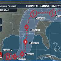
The Atlantic season’s first hurricane could take shape this week, bringing a growing threat that may extend well beyond the coast.Click here for a new, updated story - Tropical Storm Isaias Forms: Hurricane Forecast Moves EarlierThe National Hurricane Center said in its Tuesday morning, Oct. 6, update that a tropical depression will likely form over the southwestern Gulf within about a ...
-

by
Joe Lombardi
National Interest
A historic Nor’easter that swept through the region has left some jaw-dropping numbers in its wake, both in terms of snowfall totals and wind gusts.The storm caused widespread disruptions, including road closures, power outages, and flight cancellations, but also delivered some record-breaking snow totals.Snowfall TotalsThe heaviest snow fell across parts of Rhode Island, Massachusetts, ...
-

by
Cecilia Levine
Weather
New Jersey Lt. Gov. Tahesha Way has declared a State of Emergency effective Saturday. Oct. 11 at 10 p.m. ahead of a powerful coastal storm forecast to bring flash flooding, heavy rain, and damaging winds to the state through Monday, Oct. 13.According to the National Weather Service’s Mount Holly office, significant impacts are increasingly likely Sunday and Monday, including moderate to ...
-

by
Joe Lombardi
National Interest
A massive, churning Hurricane Erin is turning the Atlantic into a danger zone for beachgoers from Florida to Massachusetts, prompting urgent warnings to stay out of the water as life-threatening surf and rip currents pound the East Coast on Wednesday, Aug. 20.Click here for a new, updated story: Erin’s Offshore Spin Will Unleash Flash Flood Risk Across NortheastThe National Hurricane ...
-

by
Joe Lombardi
National Interest
As Hurricane Erin balloons in size and power over the Atlantic, the storm is poised to unleash life-threatening surf, dangerous rip currents, and coastal flooding up and down the US East Coast starting Tuesday, Aug. 19.Beachgoers and coastal residents from Florida to New England are bracing for a turbulent week as Hurricane Erin, now a major Category 3 storm, churns slowly northward off ...
-

by
Joe Lombardi
National Interest
Hurricane Erin had grown into a monstrous force in the Atlantic, and its next move could spell trouble for some of the East Coast’s most vulnerable spots.Packing winds that peaked at 160 mph, Erin has weakened to a still-dangerous Category 3 storm Sunday morning, Aug. 17, churning up life-threatening surf and rip currents from the Carolinas to New England. The National Hurricane Center ...
-

by
Joe Lombardi
National Interest
Tropical Storm Chantal made landfall just before sunrise Sunday, July 6, near Litchfield Beach, South Carolina, bringing strong winds, torrential rain, and storm surge to parts of the state’s coast.The National Hurricane Center said tropical storm conditions will persist in the warning area through Sunday morning, with heavy rainfall continuing across South Carolina through the day and ...
-

by
Joe Lombardi
National Interest
A powerful hurricane has slammed into southern Mexico, marking a historic first for the tropical calendar.Hurricane Erick made landfall early Thursday, June 19, near the southwestern coast of Oaxaca as a Category 3 storm, unleashing destructive winds, storm surge, and torrential rainfall. It is the first major hurricane on record to strike Mexico during the month of June."Erick has been ...
-

by
Joe Lombardi
National Interest
Tropical Storm Rafael has now become a hurricane, with its projected path now uncertain.It made landfall in western Cuba as a major Category 3 storm in Cuba late Wednesday afternoon, Nov. 6, with life-threatening storm surge, damaging hurricane-force winds, and destructive waves reported, along with 115 mph winds.Tropical storm conditions are then possible in the Florida Keys late in ...
-

by
Chris Spiker
Your Community
Dale Parisi's third-generation cottage near the Mantoloking beachfront was destroyed by Hurricane Sandy in 2012."It was a very sad day," he said. "We had no idea what the future held for any of us. While some people cashed in their chips, I believed that someday we were going to return and rebuild."Nearly a dozen years later, Parisi moved into his new three-bedroom duplex in the Osborn ...
-

by
Joe Lombardi
National Interest
The projected timing for a potentially major hurricane taking aim at the US coast has been updated and is earlier than some initial projections.AccuWeather is forecasting a powerful Category 3 hurricane with maximum sustained wind gusts of 110 to 130 miles per hour to make landfall along the Gulf Coast on Thursday, Sept. 26, likely in the Big Bend on Florida's west coast.“This is ...
-
by
Zak Failla
Weather
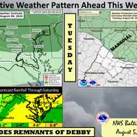
Virginia Gov. Glenn Youngkin has declared a State of Emergency as possibly wicked weather continues to head toward the region with Tropical Storm Debby continuing to move north up the coast.On Tuesday, citing "National Weather Service and National Hurricane Center forecasts that indicate a tropical storm with significant rainfall and flooding across the entire Commonwealth could cause ...
-

by
Joe Lombardi
National Interest
The most intense rainfall from Debby, which made landfall as a Category 1 hurricane over Florida's Big Bend, is still to come, and the storm is now expected to affect the Northeast later this week.Landfall was around 7 a.m. Monday, Aug. 5 about 70 miles southeast of Tallahassee, the National Hurricane Center said. It was downgraded to a tropical storm shortly thereafter as it hit ...
-

by
Joe Lombardi
National Interest
A newly named, rapidly strengthening tropical storm is likely to become the first hurricane of the 2024 season.Tropical Storm Beryl, the second named storm since the season began on Saturday, June 1, is now located about 820 miles east-southeast of Barbados. It has maximum sustained winds of 65 miles per hour and is moving west at 23 miles per hour.Beryl is expected to become a major ...
-

by
Ben Crnic
Weather
With Hurricane Lee barreling on a path toward the Northeast, meteorologists have now identified the areas of Massachusetts that may face the most devastation and power outages from storm surges and damaging winds. According to the latest information from the National Weather Service, the storm is expected to arrive in southern New England on Friday night, Sept. 15, and stay through ...
-

by
Joe Lombardi
Weather
Ian has strengthened to Category 4 hurricane status and its projected path has changed as it nears a direct hit on the southwest Florida coast with the potential to be one of the most devastating and costly storms in US history.Early Wednesday morning, Sept. 28, the center of Ian is now heading straight to the Fort Myers/Sarasota, Florida area, a notable shift in the path to the south ...
-

by
Joe Lombardi
Weather
With its sustained wind strength of 70 miles per hour just short of hurricane status, Tropical Storm Henri is expected to make landfall between Montauk Point and Rhode Island late Sunday morning, Aug. 22.Since Saturday morning, Henri's track has shifted about 50 miles to the east, making landfall on Long Island less likely now.Henri (pronounced ON-ree) became a Category 1 hurricane late ...
-

by
Joe Lombardi
Weather
A brand-new projected track for Tropical Storm Henri has shifted it even farther to the west, enhancing the risk of power outages and flashing flooding for the region.The latest models were released Friday afternoon, Aug. 20 by the National Weather Service NOAA National Hurricane Center.If it strengthens to hurricane status as expected, Henri could be the first hurricane to make ...
-

by
Joe Lombardi
Weather
Click here for an updated story: Brand-New Forecast Has Henri Tracking Farther West, Enhancing Potential Risk For RegionThe projected track for Tropical Storm Henri has shifted to the west, putting millions of residents in the Northeast at risk of flash flooding and power outages.If it strengthens to hurricane status as expected, Henri could be the first hurricane to make landfall in ...
-

by
Joe Lombardi
Weather
Scattered severe thunderstorms with heavy rain, strong winds and hail are expected, with isolated tornadoes possible, ahead of the anticipated arrival of Hurricane turned Tropical Storm Isaias. Showers and storms are possible starting Sunday morning, Aug. 2. The likelihood of storms increases Sunday afternoon and evening.The highest chance for storms will be north and west of New York ...
-
by
Joe Lombardi
Weather
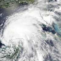
Future tropical cyclones, or hurricanes, will feature more intense rain with more rain produced per hour than previous storms but fewer hurricanes will make landfall, according to predictions in a brand-new study.The researchers at the School of Marine and Atmospheric Sciences at Stony Brook University announced the findings on Monday, June 15.Published early online in Geophysical ...
-

by
Joe Lombardi
Weather
Major hurricane Dorian is expected to slowly approach the eastern Florida coastline late in the day on Tuesday, Sept. 3, before starting a days-long northerly trek that could affect the New York area with Tropical Storm-force winds at the end of the workweek.Dorian will remain a large and dangerous hurricane as the storm tracks northward near or just offshore the Florida east coast ...
-

by
Joe Lombardi
Weather
With maximum sustained winds of 175 miles per hour as it nears the Bahamas, Hurricane Dorian was upgraded to Category 5 status at 9:30 a.m. on Sunday, Sept. 1.The slow-moving monster storm is about 200 miles east of West Palm Beach, Florida, meandering at about 8 mph.In its latest advisory, issued at 8 a.m. Sunday, the National Hurricane Center still predicted Florida would avoid a ...
-

by
Joe Lombardi
Weather
Click here for an updated story: Eye On The Storm: Here's What To Expect And When Nor'easter Roars Through AreaAs Hurricane turned Tropical Depression Willa dumps rain on the south while barreling north, more details on the timing and strength of the Nor'easter that will hit the area this weekend are emerging.On Friday, Mid-Atlantic states will see Gale-force winds at the coast of ...
-

by
Joe Lombardi
Weather
Click here for an updated story: Florence Now Likely To Soak Parts Of New York According To Latest Forecast ModelWith Hurricane Florence's outer bands now nearing the Carolina Coast, millions of people in several states are now bracing for a days-long stretch of massive amounts of rain, devastating flooding and 100-plus mile-per-hour winds that could knock out power to some for ...
-

by
Joe Lombardi
Weather
Click here for an updated story: East Coast Braces For Massive Amounts Of Rain, Devastating Flooding From FlorenceThere has been a dramatic change in the projected path of the first hurricane of the season expected to make landfall on the United States.The latest tracks for Category 4 storm Florence, released early Wednesday morning, now have the storm staying farther south, following ...
-

by
Joe Lombardi
Weather
Click here for an updated story: Dramatic Change In Path Projected As Cat 4 Hurricane Florence Closes In On CoastMore than 1.5 million people have been ordered to evacuate along 300 miles of coastline from the Carolinas to Virginia as a monster and strengthening Category 4 storm is poised to become the first hurricane of the season to make landfall on the United States.Hurricane ...


